-
Netherlands
- more about this country
- Afghanistan
- Albania
- Algeria
- American Samoa
- Andorra
- Angola
- Anguilla
- Antigua and Barbuda
- Argentina
- Armenia
- Aruba
- Australia
- Austria
- Azerbaijan
- Bahamas, The
- Bahrain
- Bangladesh
- Barbados
- Belarus
- Belgium
- Belize
- Benin
- Bermuda
- Bhutan
- Bolivia
- Bosnia and Herzegovina
- Botswana
- Brazil
- Brunei
- Bulgaria
- Burkina Faso
- Burundi
- Cambodia
- Cameroon
- Canada
- Cape Verde
- Cayman Islands
- Central African Republic
- Chad
- Chile
- China
- Christmas Island
- Cocos (Keeling) Islands
- Colombia
- Comoros
- Congo, Democratic Republic of the
- Congo, Republic of the
- Cook Islands
- Costa Rica
- Cote d`voire
- Croatia
- Cuba
- Cyprus
- Czech Republic
- Denmark
- Djibouti
- Dominica
- Dominican Republic
- East Timor
- Ecuador
- Egypt
- El Salvador
- Equatorial Guinea
- Eritrea
- Estonia
- Ethiopia
- Falkland Islands (Islas Malvinas)
- Faroe Islands
- Fiji
- Finland
- France
- French Guiana
- French Polynesia
- Gabon
- Gambia, The
- Georgia
- Germany
- Ghana
- Gibraltar
- Greece
- Greenland
- Grenada
- Guadeloupe
- Guam
- Guatemala
- Guernsey
- Guinea
- Guinea-Bissau
- Guyana
- Haiti
- Honduras
- Hong Kong
- Hungary
- Iceland
- India
- Indonesia
- Iran
- Iraq
- Ireland
- Israel
- Italy
- Jamaica
- Japan
- Jersey
- Jordan
- Kazakhstan
- Kenya
- Kiribati
- Korea, North
- Korea, South
- Kuwait
- Kyrgyzstan
- Laos
- Latvia
- Lebanon
- Lesotho
- Liberia
- Libya
- Liechtenstein
- Lithuania
- Luxembourg
- Macau
- Macedonia, The Former Yugoslav Republic of
- Madagascar
- Malawi
- Malaysia
- Maldives
- Mali
- Malta
- Marshall Islands
- Martinique
- Mauritania
- Mauritius
- Mayotte
- Mexico
- Micronesia, Federated States of
- Moldova
- Monaco
- Mongolia
- Montenegro
- Montserrat
- Morocco
- Mozambique
- Myanmar
- Namibia
- Nauru
- Nepal
- Netherlands
- Netherlands Antilles
- New Caledonia
- New Zealand
- Nicaragua
- Niger
- Nigeria
- Niue
- Norfolk Island
- Northern Mariana Islands
- Norway
- Oman
- Pakistan
- Palau
- Panama
- Papua New Guinea
- Paraguay
- Peru
- Philippines
- Pitcairn Islands
- Poland
- Portugal
- Puerto Rico
- Qatar
- Reunion
- Romania
- Russia
- Rwanda
- Saint Helena
- Saint Kitts and Nevis
- Saint Lucia
- Saint Pierre and Miquelon
- Saint Vincent and the Grenadines
- Samoa
- San Marino
- Sao Tome and Principe
- Saudi Arabia
- Senegal
- Serbia
- Seychelles
- Sierra Leone
- Singapore
- Slovakia
- Slovenia
- Solomon Islands
- Somalia
- South Africa
- Spain
- Sri Lanka
- Sudan
- Suriname
- Svalbard
- Swaziland
- Sweden
- Switzerland
- Syria
- Taiwan
- Tajikistan
- Tanzania
- Thailand
- Togo
- Tokelau
- Tonga
- Trinidad and Tobago
- Tunisia
- Turkey
- Turkmenistan
- Turks and Caicos Islands
- Tuvalu
- Uganda
- Ukraine
- United Arab Emirates
- United Kingdom
- United States (USA)
- Uruguay
- Uzbekistan
- Vanuatu
- Venezuela
- Vietnam
- Virgin Islands (USA)
- Wallis and Futuna
- Western Sahara
- Yemen
- Zambia
- Zimbabwe
-
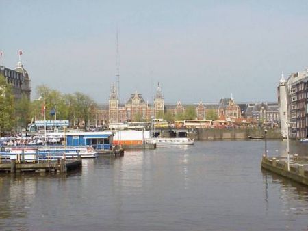
Amsterdam
- more about this city
- Aalten
- Alkmaar
- Almelo
- Almere
- Amersfoort
- Amsterdam
- Apeldoorn
- Arnhem
- Assen
- Asten
- Baarle-nassau
- Barneveld
- Bergen op zoom
- Beverwijk
- Bladel
- Boxmeer
- Breda
- Brouwershaven
- Buitenpost
- Burgh
- De Waluwe
- Delft
- Delfzijl
- Den Burg
- Den Helder
- Deurne
- Doetinchem
- Dokkum
- Dordrecht
- Dronten
- Dventer
- Ede
- Eibergen
- Eindhoven
- Emmeloord
- Emmen
- Enkhuizen
- Enschede
- Epe
- Geldermalsen
- Geleen
- Gemert
- Gennep
- Gilze
- Goes
- Goirle
- Goor
- Gorinchem
- Gouda
- Groningen
- Haaksbergen
- Haarlem
- Hardenberg
- Harderwijk
- Harlingen
- Heerenveen
- Heerlen
- Hengelo
- Hertogenbosch
- Hilvarenbeek
- Hilversum
- Hoeven
- Hoofddorp
- Hoogeveen
- Hooghuis
- Hoorn
- Kampen
- Leerdam
- Leeuwarden
- Leiden
- Lelystad
- Lichtenvoorde
- Lisse
- Lochem
- Maastricht
- Meppel
- Middelbeers
- Middelburg
- Middelharnis
- Nieuwegein
- Nieuwerkerk
- Nijmegen
- Nijverdal
- Ommen
- Oosterhout
- Oosterland
- Oosterwolde
- Oss
- Purmerend
- Raalte
- Roden
- Roermond
- Roosendaal
- Rotterdam
- Sittard
- Sneek
- Stadskanaal
- Steenbergen
- Steenwijk
- Stogger
- Terneuzen
- The Hague (s-Gravenhage)
- Tiel
- Tilburg
- Uddel
- Uden
- Uithoorn
- Ulft
- Uplengen
- Utrecht
- Valkenswaard
- Veendam
- Veghel
- Venlo
- Venray
- Weert
- Winschoten
- Winterswijk
- Wolvega
- Zaanstad
- Zierikzee
- Zoetermeer
- Zuidhorn
- Zutphen
- Zwolle
- Contacts